Landscape design
2023 Carpugnane Urban Park
The project for the Carpugnane Park was born in 2006-2009 as environmental compensation of the extension of the third lane of the A1 motorway between Milan and Naples, in the section between Sasso Marconi and Incisa Valdarno (SPEA-ASPI project). In 2020, the design, construction and management of the park have been managed by the Municipality of Calenzano, which revised the original project to adapt it to the new needs of the population and with a view to greater naturalness.
WHERE
Municipality of Calenzano – Province of Florence – Tuscany Region – Italy
WHEN
2007-2009. Final design and executive design, SPEA-ASPI
2020-2021. Feasibility project, Municipality of Calenzano
2022-2023. Final design, First section, Municipality of Calenzano
2023. Executive projects, First section, Municipality of Calenzano
2024-2025. Work in progress, First section
WHO
Clients/ SPEA Ingegneria Europea SpA. Milan; Municipality of Calenzano Srl.
Designers/ SPEA-ASPI Project: Arch. L. Vallerini (project coordination and appointed designer), in collaboration with Arch. G. Bologni, E. Gregorini, S.Lateana – ArchLandStudio Florence. Consultants: Dott.for. L.Luciani, Eng. S.Monni – Soc. HYDEA SpA Florence; Arch. M.Manoni, T.Lettere – Meta Studio San Casciano (Fi); Arch. G.De Stefano – 3dSign – the rendering & animation studio Florence
Designers/ Projects Municipality of Calenzano: Arch. L.Vallerini (technical coordination of the PdF, PD and PE project), in collaboration with Arch. L.Nofroni, Dott.agr. G.Fabbri, Dott.designer. L.Vallerini – ArchLandStudio Florence; Dott.for. L. Luciani, Eng. S.Monni, Ph.D. G.Tona – Soc. HYDEA SpA Florence, Ph.D. C. Scoccianti – WWF Committee for the Wetlands of the Florentine Area
WHAT
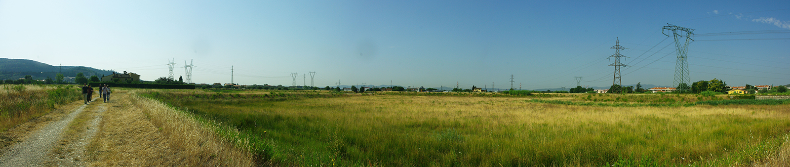
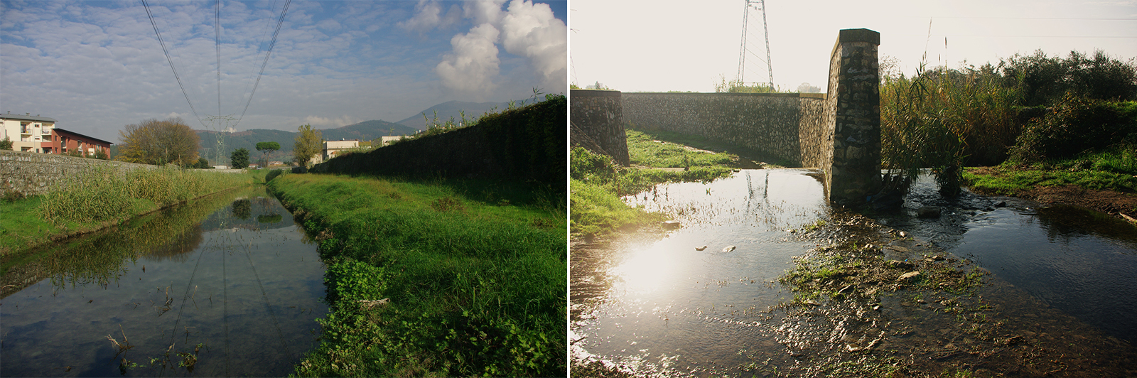
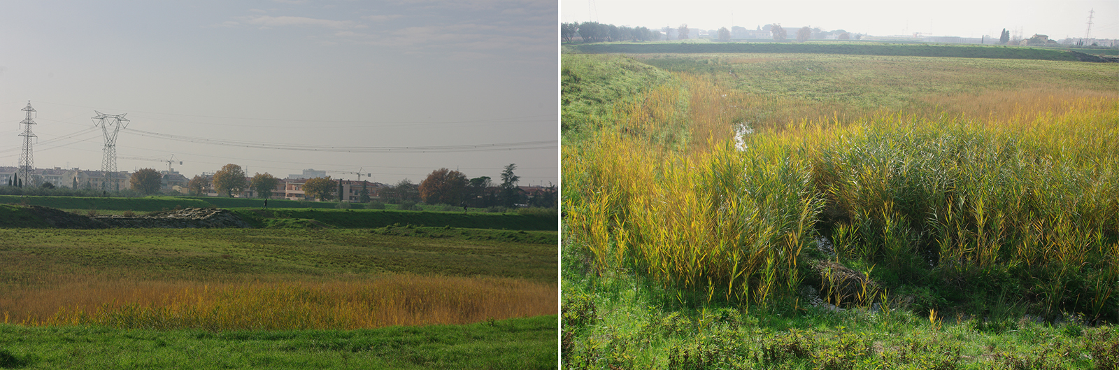
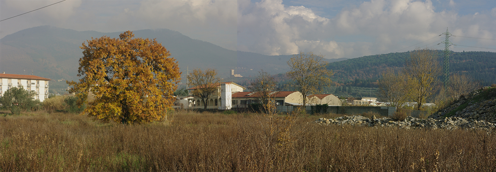
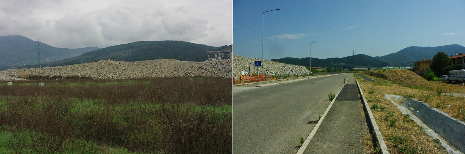
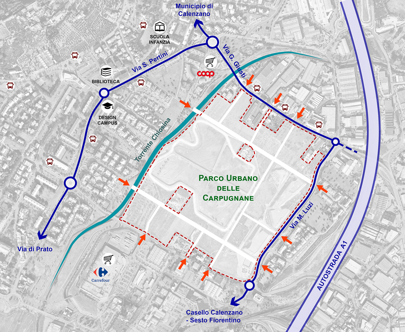
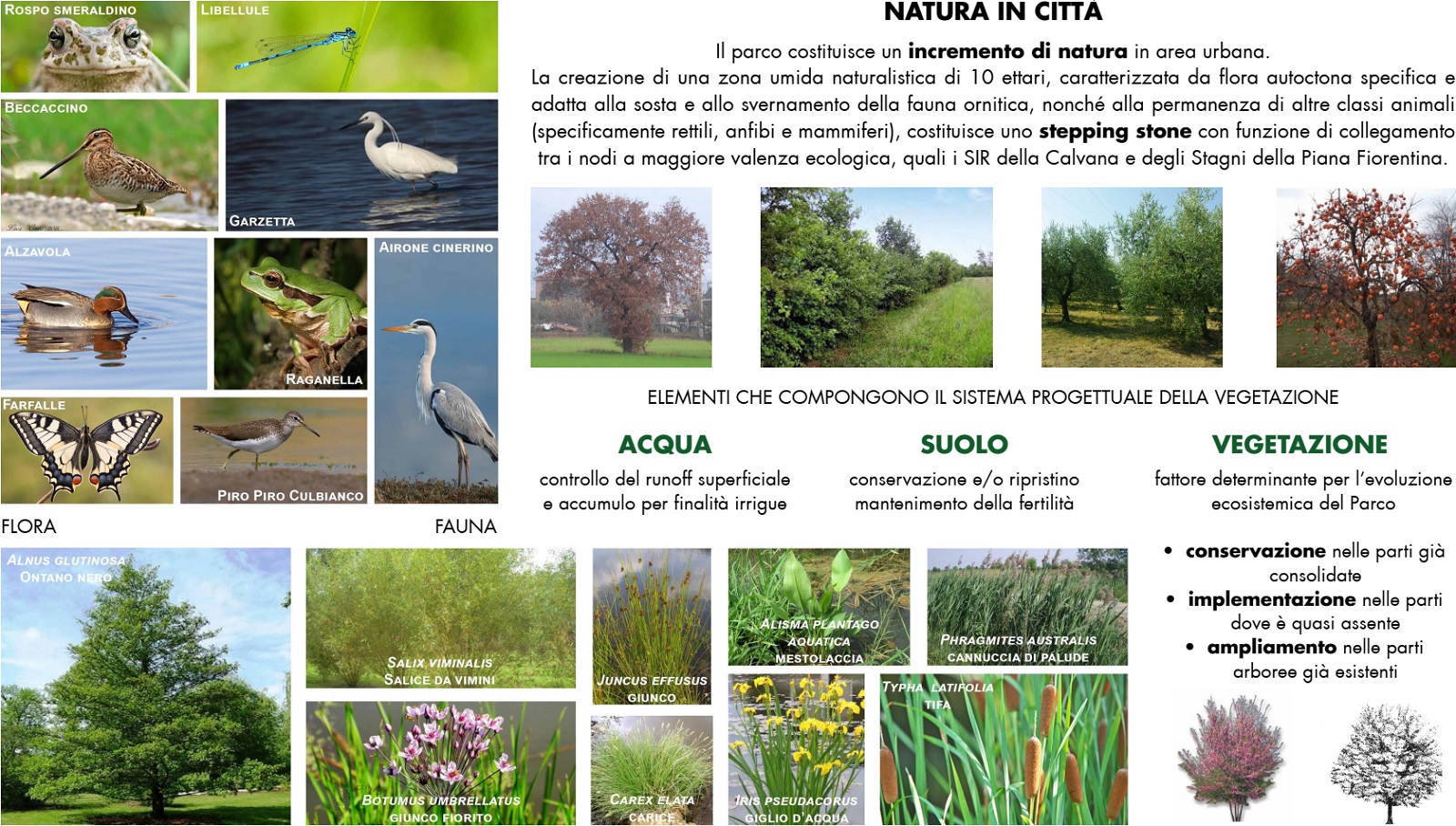
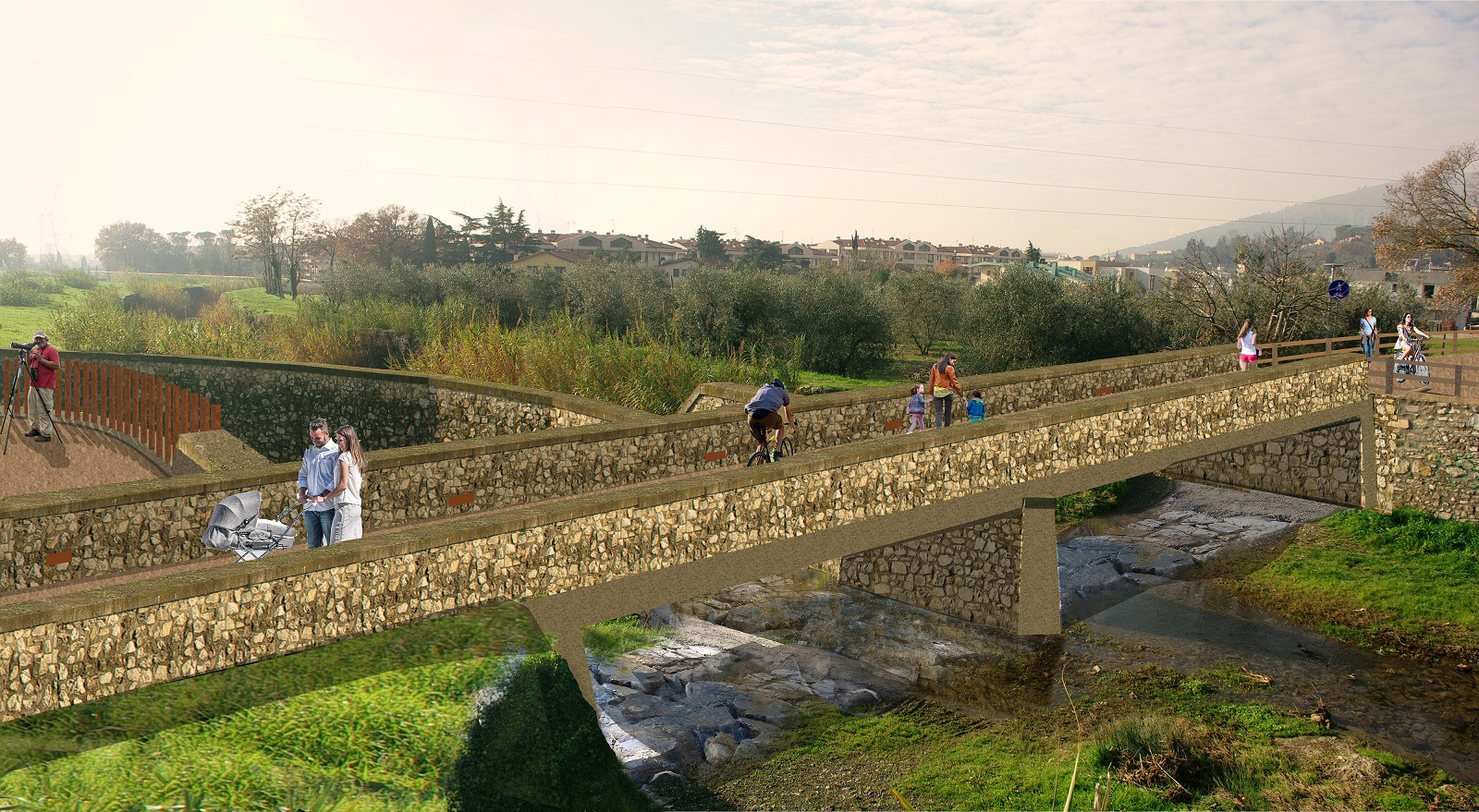
The park area is located in a densely urbanized area with a total surface of about 32 hectares, of which about 10 are the overflow basin of the stream Chiosina. Currently it appears as an area resulting from urban development. While the edges, in direct contact with the urban agglomerations, have been used as warehouses, storage of materials, shacks, etc., the central areas are still used for residual agricultural production with mixed vineyards and olive groves sometimes combined with arable land.
The Project aims to overturn the current state by giving new scope to this area and transforming it into a “living body” for the city, through the following objectives and strategies:
- The park as a structural function to integrate the park into the urban context;
- The park as an ecosystem to perform an ecological function within the city;
- The park as a “living” place to encourage aggregation, participation and active involvement of citizens;
- The park as an integrated system of public and private management.
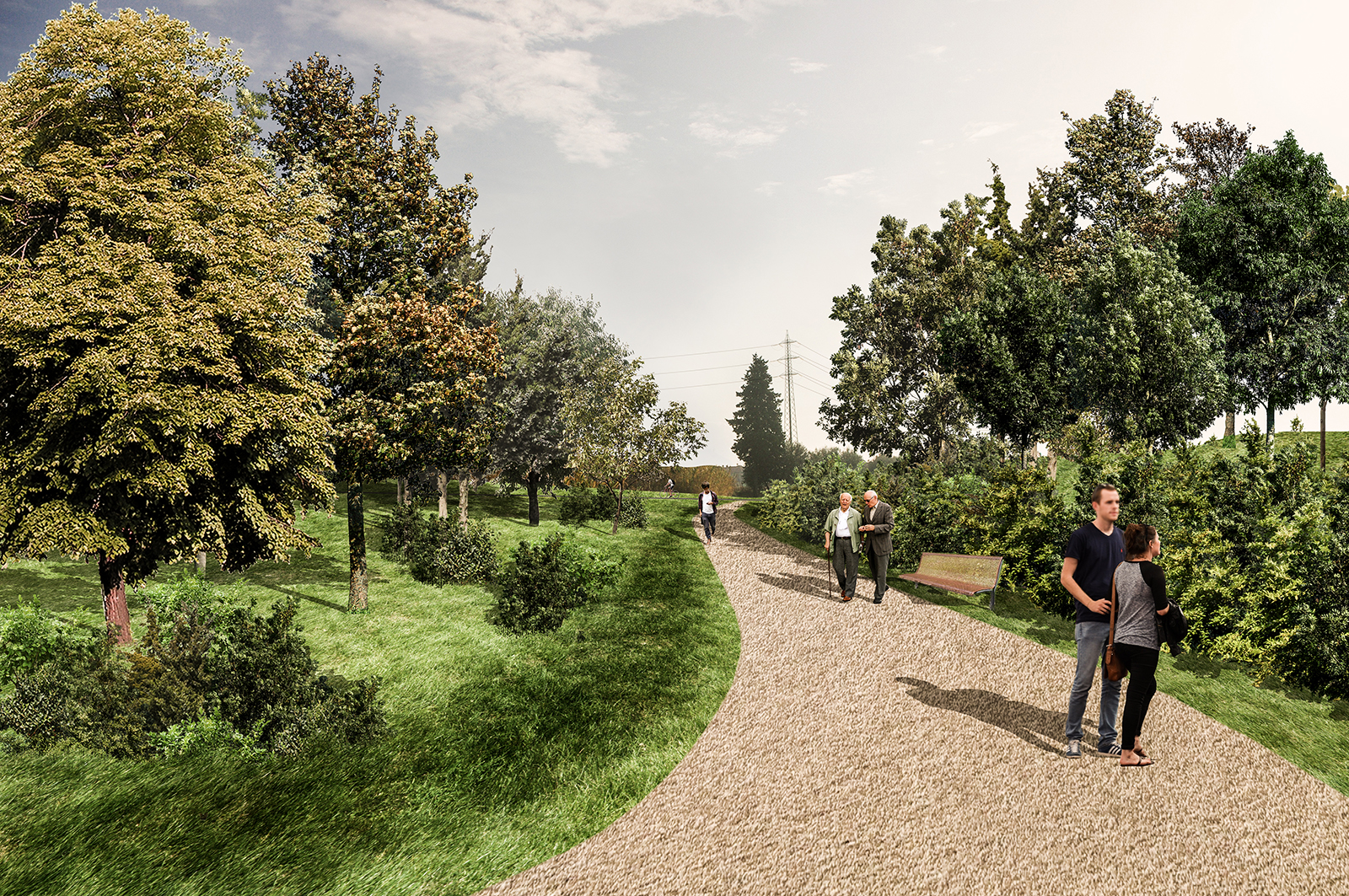
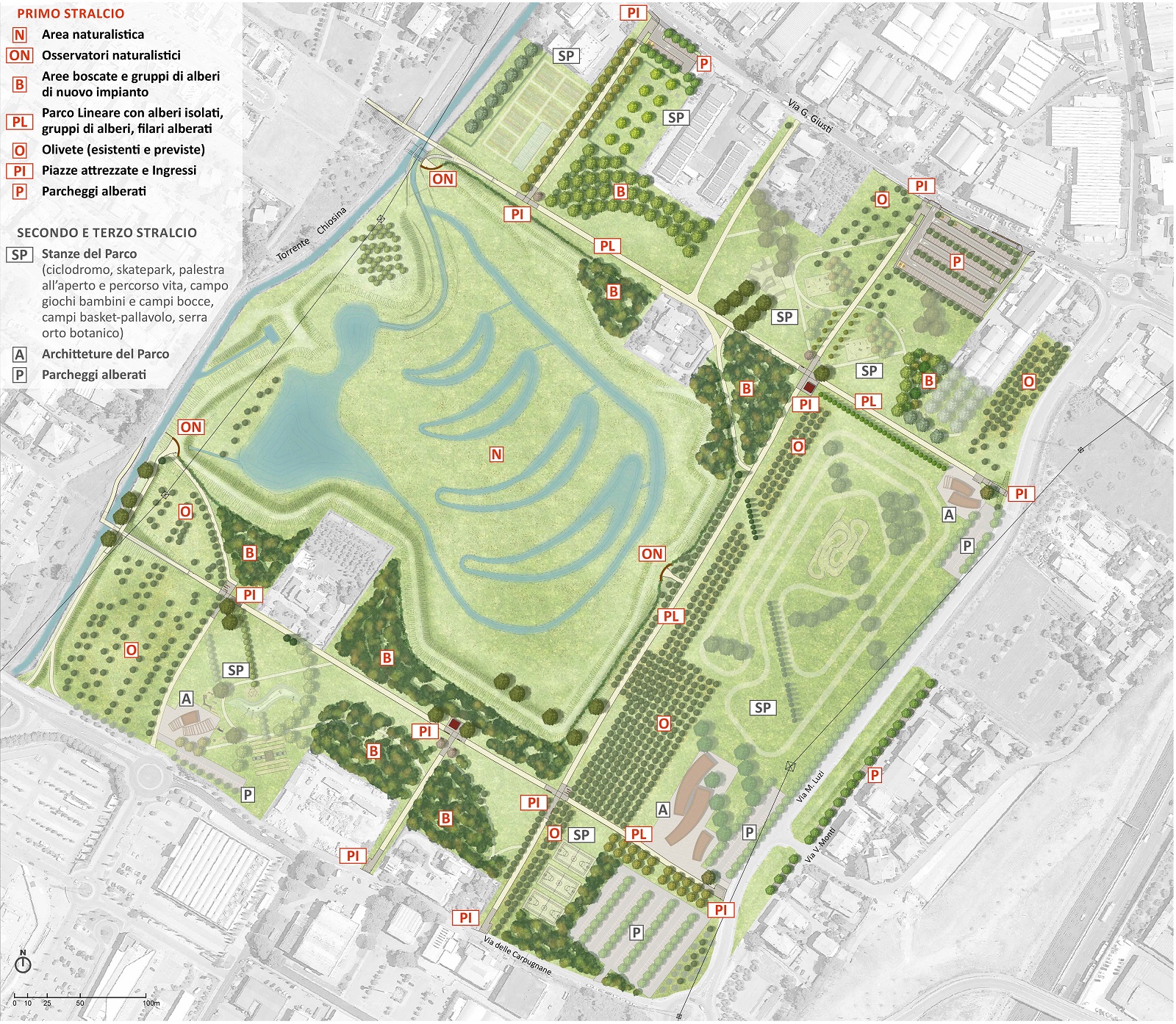
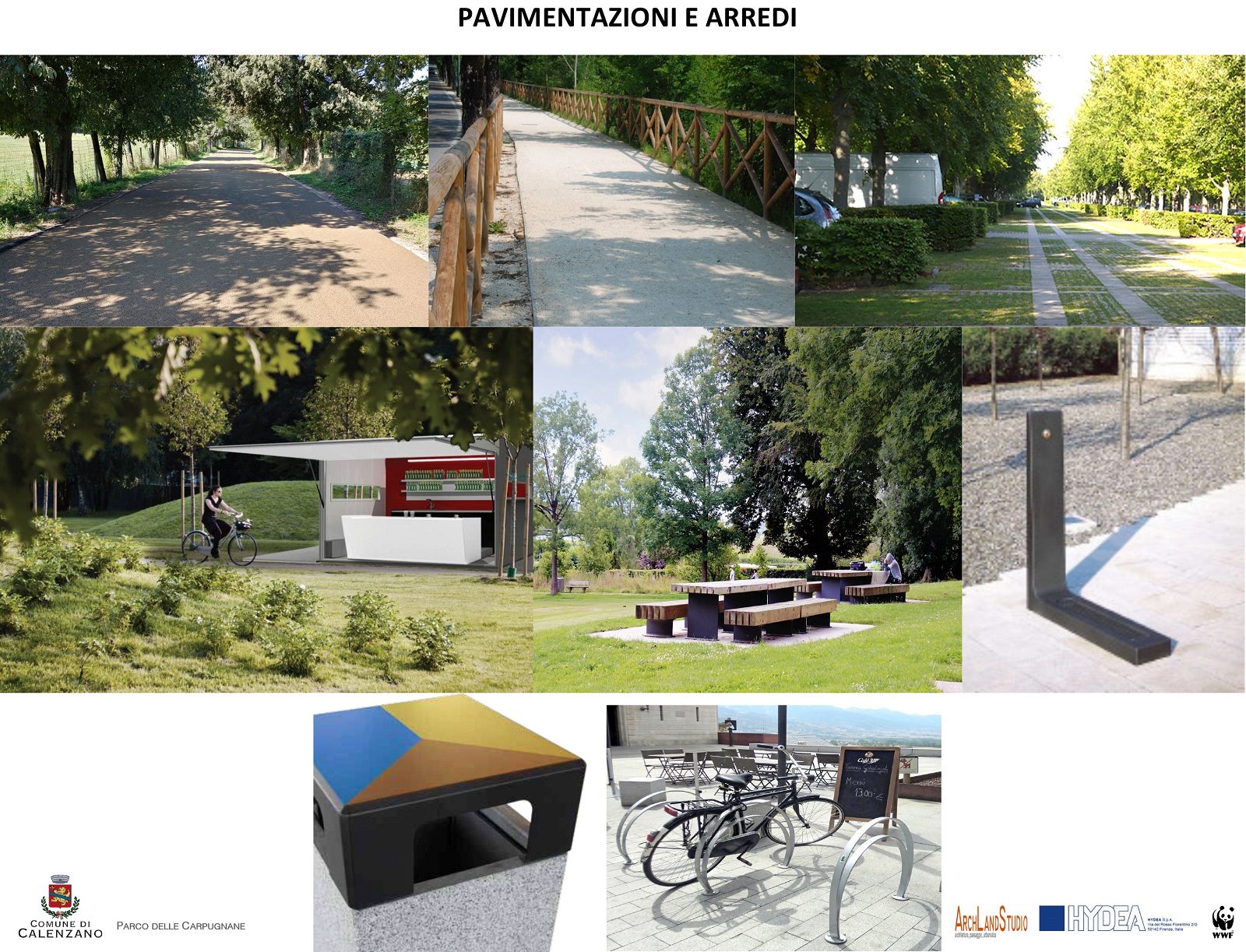
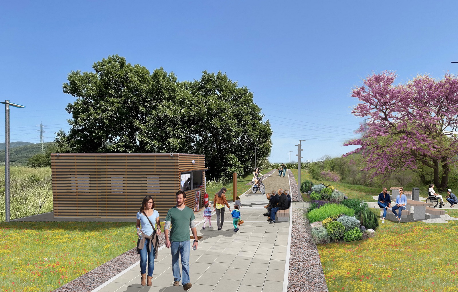
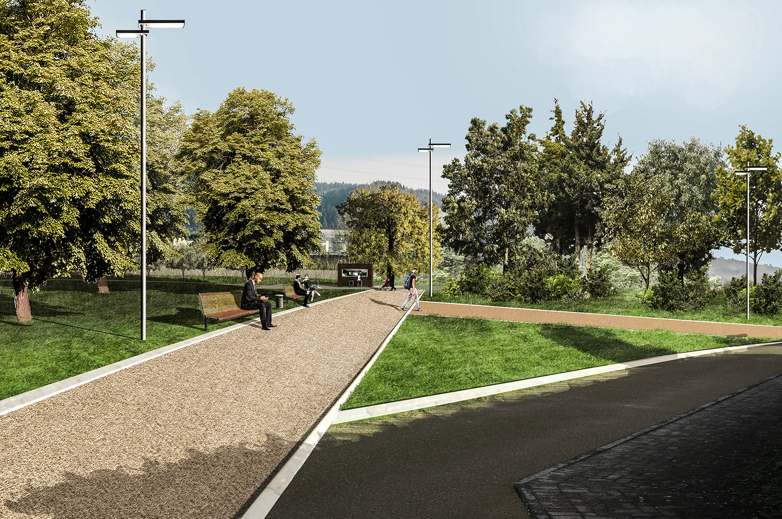
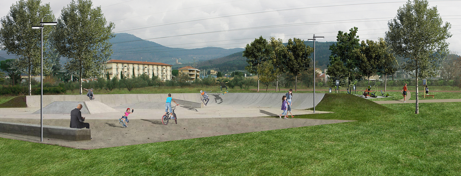
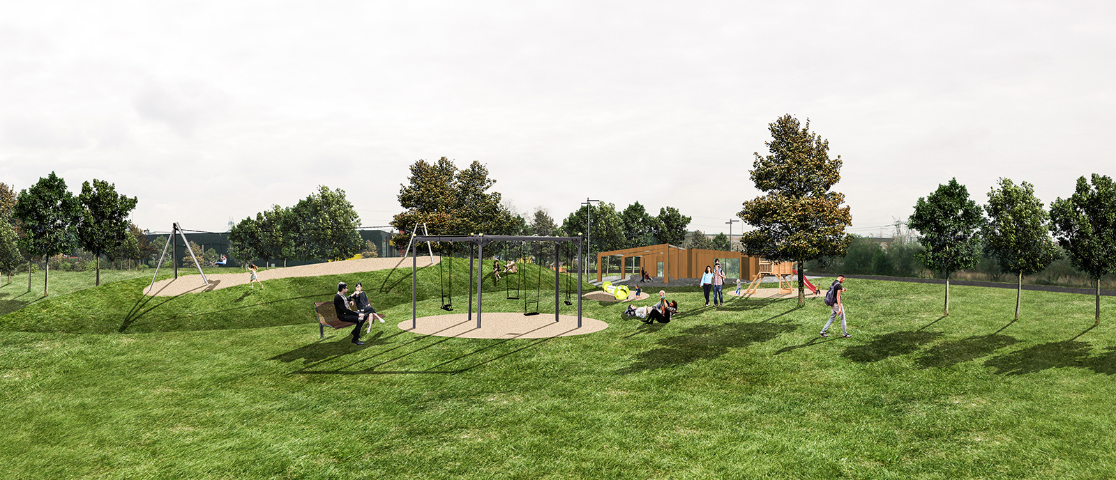
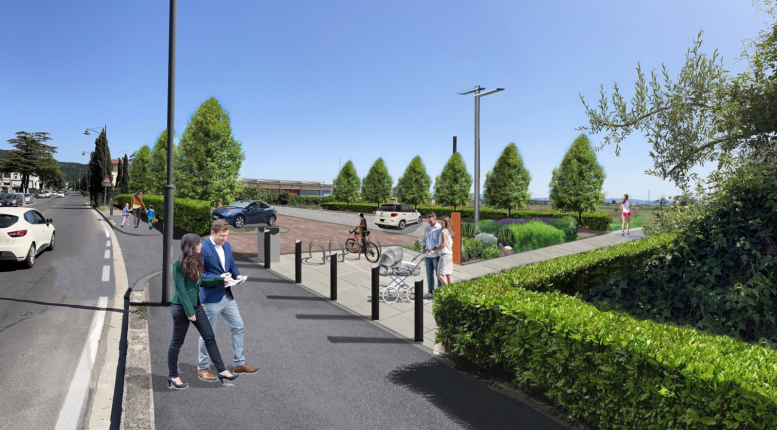
The design of the Park is based on a structure consisting of a strip of equipped and green spaces 20-30 meters wide, called “Linear Park”, within which the main road system runs, to which secondary paths, squares, parking lots, accesses and services are connected. The central nucleus is represented by the Naturalistic Area of about 10 hectares with humid environments dedicated to the stopover of migratory birds and protected by a belt of earth embankments and wooded areas that reduce disturbances caused by man. On the North, South and East sides are the “Rooms” of the Park with sports, recreational, cultural and leisure functions for all age groups. Some areas are characterized by new Architectures whose forms and functions are related to those of the park with particular attention to environmental components. The vegetation of the first phase of the project consists of 453 existing trees to be maintained and 1,297 newly planted trees, with 2,695 m2 of newly planted shrubs and 57,815 m2 of new lawns.